


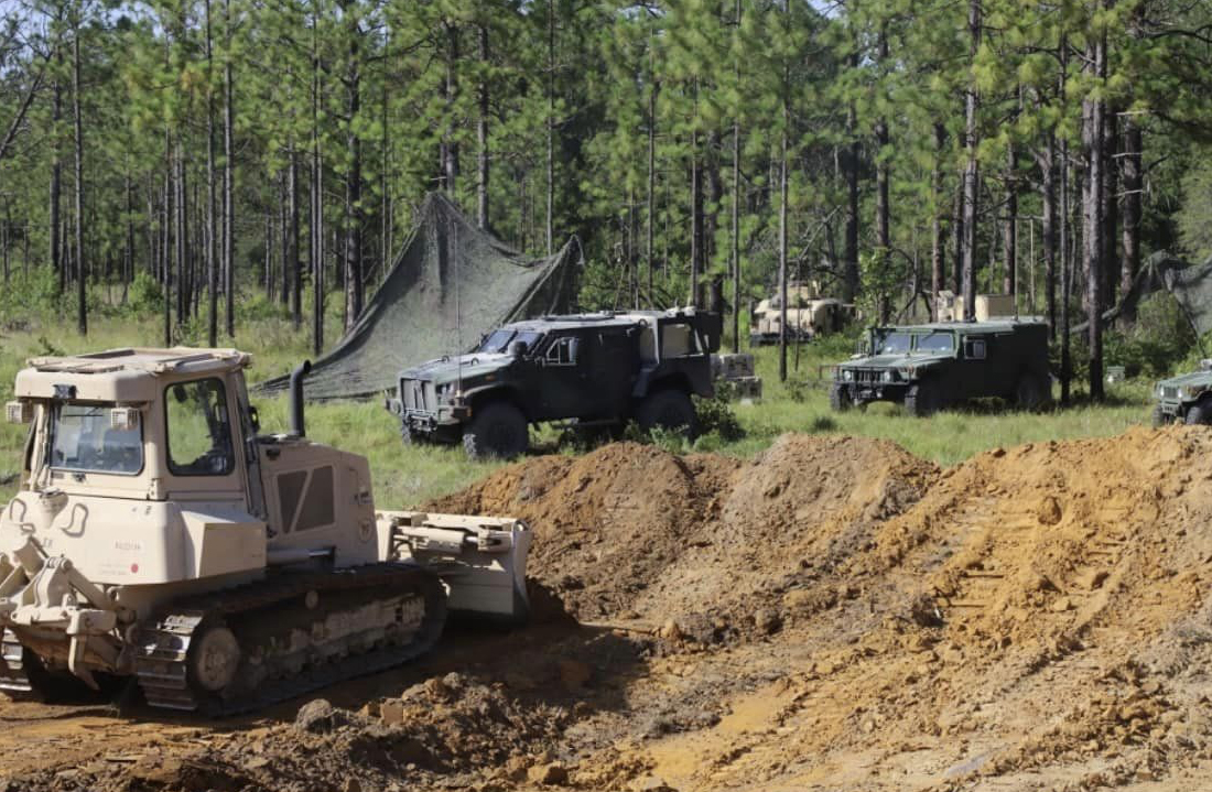
 Equipment and vehicles are moved into position during one of several large-scale training exercises throughout the year at Fort Polk, Louisiana. Photo by JRTC/Fort Polk
 BY TIM SCHOMMER
On a cool, but sunny morning in mid-October, the sun slowly rose over the acres of towering longleaf pines that cover most of Fort Polk, a U.S. Army installation in west-central Louisiana. I was traveling down a dirt road through the pine forest in a pickup, with three seasoned land management operators, who were showing me around the installation’s training lands.
Fort Polk, roughly 150 miles west of Baton Rouge, is a 240,000 acre swath of predominantly longleaf pine forest, an optimal setting for preparing soldiers for overseas combat. The installation supports the Joint Readiness Training Center (JRTC), which provides advanced-level training for Army, Air Force, Army National Guard, Navy, and Marine units under conditions simulating low- and mid-intensity conflicts. JRTC typically conducts 10 training rotations per year. These combined rotations involve the coordination of thousands of soldiers and the maneuvering of hundreds of vehicles, including Humvees, tanks, and other heavy equipment. I was visiting the installation to meet with members of Fort Polk’s Integrated Training Area Management (ITAM) team, a partnership between Fort Polk and my employer, the Center for Environmental Management of Military Lands (CEMML), headquartered at Colorado State University. I wanted to learn more about the extent of the training conducted on Fort Polk, and the team’s efforts in ensuring the long-term sustainability of the training environment. I was surprised to learn that a team of just 16 people is responsible for maintaining Fort Polk’s 221,000 acres of training land.
As we wove our way through pine forest on some of the installation’s over 800 miles of maneuver trails, we talked about the ITAM team’s mission, a mission the team doesn’t take lightly.
“Our role is to provide the best training environment possible so that American soldiers can safely prepare for deployment,” said Wayne Fariss, Fort Polk’s ITAM Coordinator. “If they are better prepared here, then they’re more likely to return home safely.”
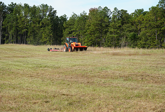
The ITAM staff of three Department of the Army Civilians and 13 CEMML employees perform a wide array of tasks, including analyzing training land conditions with remote sensors; regularly maintaining trails, water crossings, and training fields; repairing damage caused by equipment maneuvers during training and by severe weather events; and ensuring that the team’s efforts remain effective in the long term. “In the most basic terms, we manage the dirt,” said Fariss. “We repair, reconfigure and maintain the land so that it is optimal for current and future training operations.”
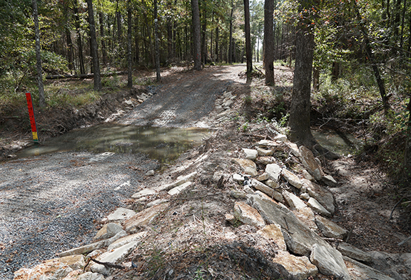
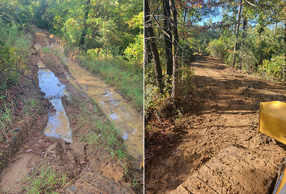
Driving farther into the forest, we stopped at areas where rehabilitation and maintenance work had recently been conducted and areas where upkeep and reconfiguration was still required. While the tasks seemed endless, my tour guides in the truck did not seem fazed in the least. They noted new maneuver damage or eroded trails, had a quick conversation about possible solutions, and we kept going.
“We build it, so they can train,” said Kerry Cooley, CEMML LRAM Operations Coordinator at Fort Polk. “It’s really that simple. If we’re not doing our jobs, then the soldiers can’t do theirs’s.” Cooley’s responsibility is to coordinate a team of heavy equipment operators in the implementation of a variety of maintenance and repair work. It’s more than just moving dirt around and filling in holes. The team tries to anticipate where future problems like erosion may occur and take actions that help prevent them, such as laying down gravel on steep dirt trails and building in run off pathways that reroute rainwater off trail. The team’s equipment operators understand the nuances of the landscape and know how to reshape it to fit a specific need.
The team uses Geographic Information System mapping to efficiently record data and create maps to conduct assessments and identify priority areas. In fiscal year 2021, the ITAM team maintained 87 multi-use clearings covering over 1,200 acres, and repaired or maintained 420 miles of trail. The team also restored nearly 600 acres that had been damaged during maneuvers.
On any given day, there is no shortage of work to be done.
Another of the team’s recent projects has been to create a new training area on 40,000 acres acquired from a logging company a few years ago. The land required additional efforts to “bring it to baseline” for JRTC training, such as widening roads and expanding clearings. Unplanned factors sometimes bring extra tasks as well. For example, in the wake of Hurricane Laura in 2020, the team spent six months clearing trees and other debris across Fort Polk in addition to their regular assessment, maintenance, and upkeep routine.
As our drive in the pickup truck came to an end and I parted ways with my tour guides, it was clear that as long as soldiers continue to be trained at Fort Polk, this team will be dedicated to ensuring the ground on which they train is in optimal condition. “We are here to reduce risk and make sure JRTC and the Fort Polk home station can carry out their training work safely and effectively,” said Roy Cloud, CEMML Range Training and Land Assessments (RTLA) Coordinator. “We’re proud to do our small part to support the military training mission.”